Ecology from a different perspective
Survey methods, thermal drone surveys and real project examples
Bat Emergence Surveys in East Sussex
Thermal Drone Surveys for Protected Species
Large historic buildings can present challenges during bat emergence surveys. Multiple roof levels, chimneys, dormers and inaccessible elevations can create blind spots from the ground and make it difficult to observe all potential bat access locations.
The footage below was captured during a test flight at a large manor house and is being used as an example of how thermal drone technology can support bat emergence surveys on complex sites.
Aerial Ecology provides thermal drone surveys and ecological support across East Sussex and surrounding areas for bat surveys and other protected species work.
Why use thermal drones for bat surveys?
Thermal drones are not intended to replace conventional bat survey methods that already work well. Smaller buildings with straightforward visibility can often be surveyed effectively using conventional approaches alone.
However, thermal drones can provide additional value on larger or more complex sites where visibility becomes restricted.
Examples include:
Large residential properties
Manor houses
Churches
Historic buildings
Multi-storey buildings
Dense vegetation around structures
Restricted or difficult survey positions
On these sites, drone methods can provide additional perspectives and help improve confidence in survey coverage while remaining integrated with conventional ecological survey techniques.
Typical Survey Design
For a site such as this, drones would not replace ground surveyors. Instead they would form part of a wider survey approach.
A typical survey setup may include:
Thermal drone coverage
Elevated roof areas
Chimneys
Dormers
Difficult-to-observe elevations
Areas with limited ground visibility
Ground surveyors equipped with:
Thermal scopes
Ultrasound bat detectors
Other Night vision aids where appropriate
Survey positions would then be selected to reduce blind spots and target likely access features.
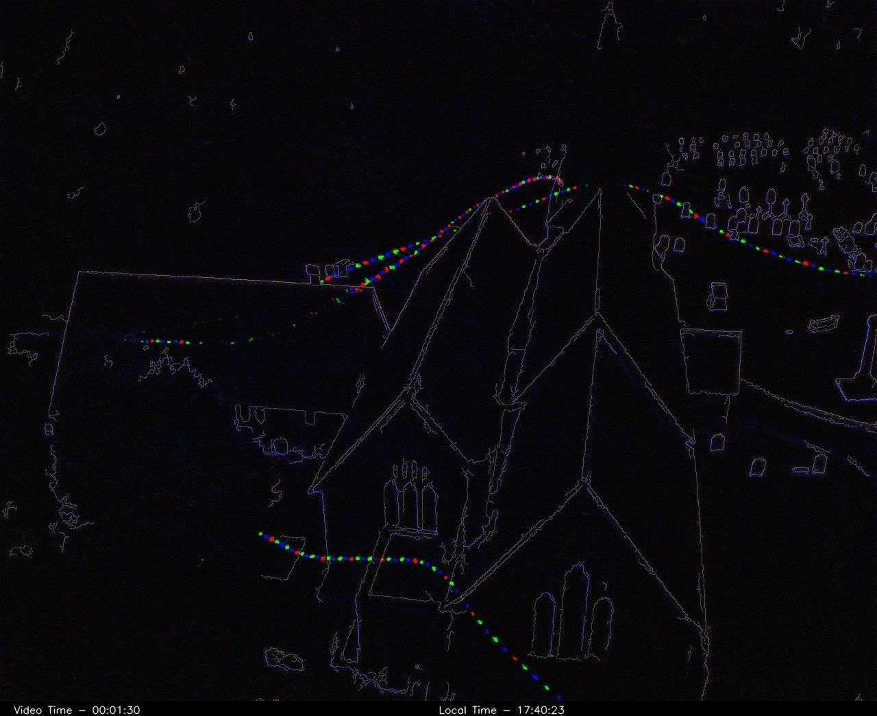
Example Outputs
Typical survey outputs may include:
Raw thermal footage
Wildlife Imaging Systems (WIS) outputs
Reviewed emergence events
Short emergence clips (30 second)
Survey interpretation and reporting
Example output from WIS